The world is changing rapidly, and technological breakthroughs and new technology is advancing fast.
Alongside these advances, apps are the way forward raising new questions and opening up brand new pathways, incorporating space technologies, and linking devices to open the market to reach more consumers.
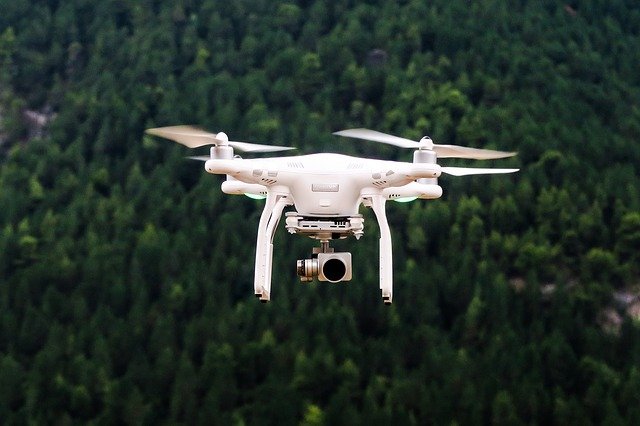
All of the following apps can be linked to drones, to support both people and industries. Please take a look at the following link, it may help you learn more https://www.drdrone.ca/. The possibilities of this technology are endless.
1. PhotoPills
PhotoPills is an app that combines the sun and moon positions predictions, using instant calculators for exposure and depth of field.
2. Google Maps
Google and Apple use drones to examine and monitor roads, street signs, and areas under construction to map locations for Google maps and Apple.
3. Kitty Hawk
Kitty Hawk links technologies and apps that support Air Control – in-flight, Pre-flight and post-flight to manage workflows as complete software.
4. Pix4D
Pix4D is a leading photogrammetry software, often used by professional designers and mappers using drone mapping technologies.
5. Litchi
Litchi is an app that enables autonomous flight when linked to DJI drone technologies. The app can be registered with Dji servers and connects the drone either via Android or iOS via a USB connection or WiFi.
6. Sun Surveyor
Sun Surveyor is an app used by professionals; film location scouts, photographers; architects, estate agents, and gardeners using interactive features to map sunrise, sunset this is incredibly beneficial when planning photoshoots and film location planning.
7. UAV Forecast
The UAV Forecast app helps you to see the weather forecast for that day; technology is driven via GPS Satellites and solar activity. It also shows flight restrictions and current No-Fly zones. There are two versions available a paid and free version; they both offer the same comparable services.
8. B4U Fly
B4U Fly is an app that links to aviation authorities, ensuring that the airspace is available before you fly. It enables you to stay compliant with airspace rules and regulations, and helps to keep you safe in the authorised airspace. You will have all the tools to make yourself accountable, and aware of legal requirements and restrictions.
9. NHS Track and Trace
The NHS Track and Trace assists in helping you stay alert knowledgeable about who you may have come into contact with the Coronavirus. NHS Track and Trace allows you t quickly and acts to prevent and protect the ones you love the most and care for your community.
The app was created collaboratively with several external organisations and international collaboration.
Track and trace work by providing you with information on if you have been in close contact with an app user who has tested positive for Covid.
It also alerts you of the levels of Coronavirus in your area.
The app links to venues and places you may have visited that have had visitors that have contracted the Coronavirus. You can also check your symptoms to check whether or not you may have the Coronavirus, and have peace of mind.
There is a facility within the app to keep track of your time during a period of self-isolation and access relevant information.
The app is also available in twelve languages to ensure that everyone can use it effectively to save lives.
10. Search and Rescue Apps
Search, and Rescue apps link with drone technology to provide accurate location searches and pinpoint the person in distress.
Volunteer Rescue is a mobile app, software and services predominantly used by emergency and rescue services to manage the emergency effectively.
The app supports Android and iOS but is also a standalone app with specific tools aligned for the rescue services. The app can be linked to access the emergency services personnel to the Volunteer Rescue service.
As a standalone app, it is also readily available to everyone, without the links to additional data for service personnel.
The app uses GPS tracking, and technology is linked to drone technologies in specific circumstances. The app also incorporates a feature that enables kit lists to be created with the ability to record the information that rescuers require in their kits.
The app also contains the following vital elements: Probability calculator – ensuring and determining the where to deploy resources; Anchor force calculator – this allows the rescuer to check the angle of the rescue and provides the force at the anchor; Redirection vector force calculator; DST60 – enable the rescuer to input the distance, speed and time.